Snowdon 25k & 50k
£8.99
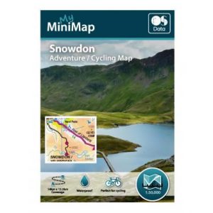
– Snowdon Map Pack | MiniMap uses Ordnance Survey 1:25,000 & 1:50,000 Scale mapping to bring you walking maps that will be very familiar to you.
– 2 x Pocket Sized MiniMaps | MiniMap Folds down to a handy A6 size and fits in your pocket making it the most convenient & easy to carry printed map out there.
– Waterproof Paper | MiniMap is printed on waterproof paper – try it out!
– The 1:25k Map will cover 7 x 6.25km & the 1:50k Map will cover 14 x 12.5km – Perfect for day trips.
Snowdon is 1085 metres high and has many paths with varying difficulty that lead you up to the peak. The most popular route is the Pyg track or Miners Track which leaves from he Pen-y-Pass car park. After departing from the higher level area of the car park, you begin onto a tarmac track. When you reach a large upright stone you have joined onto the Miners Track. A second upright stone should then follow at the base of the final ascent marking several paths. The route is 7 miles long in total.